logo

STUART FLETCHER

Consultant Geophysicist

Project Summary

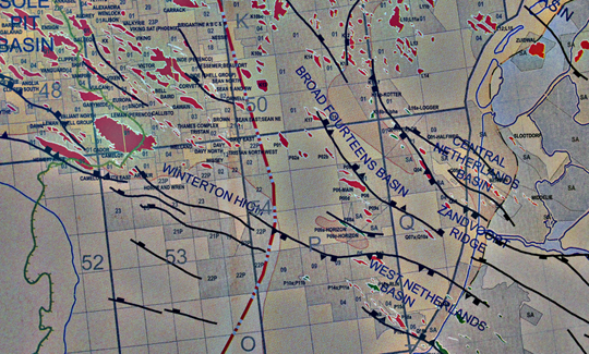
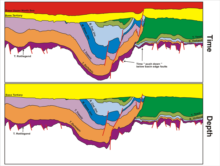
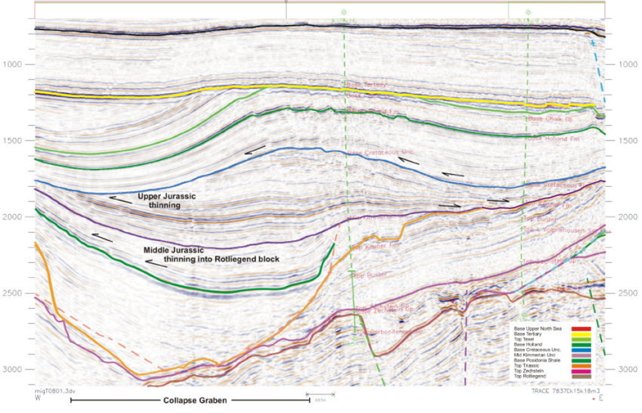
Structural mapping for a continous model across a reverse faulted basin margin.

 HomeConsultancyAbout Us More

This Broad Fourteens Basin project was carried out for a major Netherlands-based operator. Besides the structural interpretation and mapping summarised below it also included horizon provision for velocity model building and pre and post-stack parameter consultation for Pre-SDM processing and fresh prospect delineation within the Permian, Jurassic and Cretaceous stratigraphy.

BroadFourteensMap
Location of the Broad Fourteens Basin in the Netherlands Offshore

The Broad Fourteens Basin is an extension of the Jurassic Central Graben of the North Sea that has experienced a long and complicated history, involving extension, salt tectonics, inversion and subsidence, that began in the Triassic and continued into the middle Tertiary.
BroadFourteensModel
The continuous structural model built across the reverse-faulted margin and the inverted basin centre

The main aim of the project was to produce accurate structural depth maps for the Rotleigend reservoir section.
The model provides a continuous set of layers on both sides of the basin margin, accomodating the severe uplift and erosion of the basinal sediments.
A consistent set of geological properties, such as velocity, could then be assigned to the layers.
BroadFourteensSection
Key seismic elements of the Broad Fourteens Basin

I've put this section in to demonstrate the importance of structural collapse caused by salt movement.
Here, a very thick lower Jurassic section is preserved in one such collapse graben which has very thin or no underlying Triassic section. When interpreting in this area it is very important to recognize such features.
Another essential structural element to include, for an accurate structural model is the erosive mid-Jurassic unconformity.
Back to Project Summary on the Consultancy page Button.png